Thursday, June 18, 2009

June 10 - 14 Lower Lake Champlain


As we moved North on the Lake it slowly began to widen. Soon we saw the stone walls of Fort Ticonderoga. I selected an anchorage east of the fort in wide bay next to Mt. Independence. After some lunch I unloaded the dinghy and headed for a beach I had sighted below and south of the fort. During an earlier call to the fort I was told there used to be a way to get to the fort from the water. She said look for a mowed area and a red roofed barn. I beached the dinghy, walked up the mowed slope, climbed about 80 steps, crawled over a locked gate and found myself almost at the front door of the ticket office. It took three hours to do a guided tour and go through all the museums. Most of the fort had been rebuilt since time and homeowners needing stone destroyed most of the stone work. The fort was important during the Revolution since after being captured from the British by xxx many of the cannon were used to supply artillery for battles further south.

After leaving the Fort Ticonderoga anchorage we moved up past other forts used by the French or British, Crown Point and Fort St. Fredric. We passed near the fort and went over to the waterfront of Port Henry. Port Henry is famous for iron and iron ore production which lasted until the early 70's. They claim iron that went into the construction of the ironclad Monitor of 1862 Civil War fame. We decided to move a little south into Bulwagga Bay. This was a quiet bay bordered on three sides and we anchored in about 9 feet of water which still had hydrilla growing in the bottom. The next morning, as we left Bulwagga Bay anchorage, there was an overcast sky and some cloud cover over the mountains (well maybe hills is more accurate) on the west side of the river. (see Picture)


We pulled into a small bay called Basin Harbor, intending to catch a mooring ball, when the dockmaster called on VHF 16 asking if we needed a slip, so we went in and took a slip. The Dockmaster, Andy, said that as long as we went bow-in that we would have enough depth. However, he did not warn us about the need to stay close to the docks as we came in. Anyway we came to a halt in 4 feet of water. He hopped in a boat they keep there and pulled our bow around so that with the bow thruster and some throttle we could get into the slip which indeed had enough depth. The main purpose of this stop was to visit the Lake Champlain Maritime Museum. The center was about 1/2 mile from our slip so the Dockmaster called for a car from the Basin Harbor resort which occupies the ground around the Basin Harbor and the Maritime Museum. The Resort is one of the oldest in Vermont dating back to end of the 19the century. There are restaurants, cabins, recreation and catered services. We elected not to purchase the $160 massage or $20 eyebrow wax. The Maritime Museum had several buildings giving the history of Lake Champlain, the boats that sailed on its waters, the ecology of the waters, as well as crafts used in boat building. They had two replica boats. One an unusual sailing canal boat and the Philadelphia gunboat (picture). This boat was part of Benedict Arnold's fleet when they were attached by the British in 1776 near Valcour Island. The Philadelphia was sunk in the battle and the skeleton was raised out of the lake in 1934. It is now preserved at the Smithsonian Institute Museum of History in DC. I saw the remains there this year. The copy at the Maritime Museum is a working replica. The original fleet Arnold built in Whitehall NY. They were simple craft with virtually everything exposed to the elements but these craft and Arnold's leadership "discouraged" the British from attaching further south for at least a year.


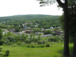
This picture shows some of the terrain of the west side of the lake.


After one day at Basin Harbor we headed north about 0745. A few miles north we found the shoaled entrance to Otter Creek and followed its winding path 8 miles down to the old Vermont town of Vergenes. Actually Vergennes claims the title of the oldest town in Vermont. We arrived there so early Saturday morning that we had no problem getting a spot at the public dock. After tying up we took a walk up the hill several blocks to the downtown. Lunch was at a cafe called Three Squares with an eclectic menu. You ordered off a chalk board with selections of five different breads and many condiments including sprouts. Pony tails, bicycle shorts and Birkenstock's were the uniform of the day for the locals. Before leaving the Lake Champlain Maritime Center, based on a recommendation from the Ticket Clerk who knew Vergennes, I had made a Saturday night reservation at Black Sheep Bistro and we enjoyed an excellent meal in downtown Vergennes. The picture shows the view of out boat from the top of the falls. We were tied up to a free public dock and even had a 50 amp hookup although I had to run the cord across an access road next to the bulkhead. We had a great view of the falls. That basin is where Captain MacDonough in 1812 built a fleet of ships to defend Lake Champlain against British invasion.


This is the view of the Vergennes Falls. As you would expect these falls were dammed to provide power for industry at the river. The small center building is actually a pump station built early in the 20th century to supply water to the fire fighting system in the town. During the second night we were there the town had a "Basin Bash" event and had a lighting of the falls as a finale. We watched as a rainbow of colors played on the rushing water.

Wednesday, June 10, 2009

June 7-9 NY Canal System

Above Troy at Waterford NY there is a decision to make. Either go west on the Erie Canal or head north on the Champlain Canal. We are going North to Canada via the Champlain Canal, Lake Champlain and the Richelieu Canal. This is a typical lock. The ropes hang down about every 20 feet. They have white/blue floats at the top. The side wall indentations contain a pipe or cable that is fixed and used to tie your boat to. The line then slides up or down the pipe/cable as the boat is raised up or down.


The Fort Edward area is the site of serious dredging. This is due to PCB's from a GE transformer factory that were released in the 1970's when a dam that previously contained them was removed. Several miles of the river bottom are now being dredged up and disposed.
Also, at Fort Edwards we met Fred Wehner who has a 34' American Tug and a web site Tug44. Fred met us at Lock 7, helped us tie up at the floating dock just south of Lock 7, gave us a tour of the old Champlain Canal locks located there, and took us to dinner at the Anvil restaurant where we had an excellent meal in this old blacksmith shop from the mid-1700's. Then it was located just outside the Ft. Edward walls.


On June 8, we stopped at Whitehall, NY. Whitehall claims to be the birthplace of the US Navy since in 1776, Benedict Arnold built a fleet of ships to fight the British in Lake Champlain.


This is our boat at the Town Dock wall looking east towards Skene Manor up on the Hill. This stone house built late in the 1800's has a panoramic view of the valley. I walked up there to see the house close up and view the town.


This view of downtown Whitehall was taken from the Skenes Manor. In the middle you can see our boat tied up at the free town wall which had electric and water and was right next to a neat museum of Whitehall history. Whitehall was originally called Skenesville for a Mr.Skenes who was a Tory in the Revolutionary War. His holdings were taken over and he fled the area after the war. Subsequently, the town name changed.


The last lock on the Champlain Canal (NY Canal System) is lock 12 at Whitehall. The last three take you down if you are North bound. The first nine we went through take you up about 16-20 feet each.

June 4-6 Upper Hudson

Continuing up the Hudson we came to the Mid-Hudson bridge that goes over to Poughkeepsie, NY on the East side. I have been over that bridge many times going to car races. When we lived in Ohio and was racing cars, there was 1-2 races a year at Lime Rock Connecticut. The crew and I would leave Thursday after work drive all night and reach Lime Rock early Friday morning. Usually I went over the Mid-Hudson bridge about sun rise. The view up and down the river was always so beautiful with the hills on each side, the water and trains running along each side of the river.

NY is celebrating the 400th anniversary of the Voyage of Henry Hudson and his "discovery" of the river named for him. In 1909 there was a huge celebration. This year there are banners everywhere, many local events, (see www.exploreny400.com) and starting June 6 a parade of sailing ships and special boats leaving from New York City and travelling all the way to Albany. One of the ships is a reproduction of Hudson's ship "Half Moon". We past this ship as it was heading south to NYC. (See picture.)


At Kingston, NY we stayed at the Kingston Town Dock that was right downtown on the Roundout Creek. This picture was from our boat. There was a Maritime Museum, a Visitors Center, historical building walking tour, and some excellent restaurants right near by.
The next day we rented a car and headed for Hyde Park to see FDR's home, tomb and the town of Hyde Park. Back in Kingston we picked up some medicine, saw the old town area (early 1600's), filled the car with groceries from WalMart and saw the movie "Up " at the local shopping mall theater.

Leaving Kingston is the Roundout Lighthouse which is a typical example of the 2-story lighthouse that is common along the Hudson. It was the largest and most recently built of eight on the Hudson. Originally one of these was the Statue of Liberty. The Saugerties Lighthouse allows overnight visitors and I saw a women doing meditation outside this lighthouse when we motored by. I guess it was a peaceful place. The Roundout Lighthouse had a tour group on it when we went by.


While heading up the Hudson we ran across two men standing on a pontoon boat that didn't appear to be moving. I turned over close and asked if they needed help. They said their motor died and they wanted a tow to another town or the boat ramp on the east side of the river about 1/2 mile away. I checked the charts and could see the depth on the east side of the river was way to shallow for Higher Ground so we anchored in 40 feet in the channel and got the dinghy down. I was able to tow them to the boat ramp where a friend brought a boat trailer to pick them up. They really needed a USPS Boat inspection or Boating Course since they apparently had no anchor (and were floating down the Hudson at nearly 2 knots), had no VHF radio, and their lines were old rope. At least all this took less than an hour and we reached out anchorage about 1600.


We rose early on Saturday June 5, to get to Troy, NY. We weighed anchor about 0715 and caught some favorable current heading north. We passed, Albany, the capital of New York state (pictured).


We reached Troy before 1100 which allowed us time to walk to the Post Office to pickup the mail we had forwarded to the downtown post office. On the waterfront there was a Saturday morning Farmer's Market so we browsed and Kendall bought an Asian meal from a vendor before we strolled back to the boat (pictured in the distance at the center of the picture.)


Right above Troy was our first lock. The Corp of Engineers runs this lock. Kaye and I read through all the guide book instructions about going through locks but it was a little nerve racking going in those high walls and figuring out where to tie and what each of us would do. The lockmasters do not help with lines. There are either pipes or cables attached at the top and bottom of the lock OR there are ropes hanging down every 20 feet or so. Skipper Bob said only tie a line from a mid-ship cleat to the pipe/cable. This was difficult for Kaye to do and difficult on a 41 foot boat. So after 2-3 locks we worked out a routine that Kaye would stand near the stern and grab a rope with a boat hook. I would get the boat close to the wall and go out and either grab a rope at the bow (using a boat hook) or run a pre-tied line from the mid-ship cleat around the pipe/cable and back to cleat. Sometimes I could do both. This technique coupled with my improving skills at positioning the boat close to the wall has us starting to look like experts.


Tuesday, June 9, 2009

June 1-3 New York City & lower Hudson River


We left the Barneget Inlet anchorage in overcast and stayed close to the coast watching the communities on the coast grow more dense as we headed north. We passed the Sandy Hook light house and the Verrazzo Narrows bridge came into view followed by the skyline of Manhattan island.


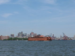
The New York City harbor was busy with ships, tugs with barges, and the Staten Island ferry.


Finally we came to the Statue of Liberty. We found the Liberty State Park anchorage down a channel to the left (East) of the Statue. Another sail boat was there and we settled in for a cool night.


On Tuesday, June 2 we moved past the Statue and up the Hudson past Ellis Island (pictured) and Manhatan. The ferries were thick in the Hudson. These were like the ones that ones that rescued the US Airways flight 1549 that "crashed" in the Hudson. One picture shows the skyline and Empire State Building.


As we moved up the Hudson we passed Grants Tomb, the Cloisters, George Washington Bridge, and interesting buildings on the New Jersey side. Pictured is the Sing-Sing prision at Ossining.


Further upriver we passed West Point.


One each side of the Hudson is a railroad track. The west side carries freight and on the east side are commuter trains and Amtrak. Late afternoon we arrived at an anchorage between Pollopel Island and the eastern shore 50 miles north of New York City. On the island is Bannerman's castle or Arsenal. It was a warehouse built in the early 1900's for war weapons and explosives for the Bannerman company war surplus business. The castle was turned over to the state of NY in 1967 and burned in 1969. It made a nice backdrop for the sundown as we were entertained with communter trains passing by a hundred yards away on the shore.


May 28 to May 31 - Delaware River & New Jersey


On May 28 we left Chesapeake City early in the morning to catch favorable currents in the Delaware River. The picture of the Salem Nuclear power plant on the NJ side of the river shows the smooth conditions we had for the first part of the trip down to Cape May. The last few hours the wind and waves kicked up some and fog reduced visibility to 1/4 to 1/2 mile.


We filled with diesel at Utsch's Marina before moving to our slip. We walked to the Lobster House for dinner. On Friday May 29, we walked about a mile to the Emlen Physick House, of circa 1872. In the old carriage house was a gift shop and Tea Room that had a nice lunch. We saw a tour trolley let off people at the house so we hopped on and rode to downtown Cape May and purchased tickets for the historical trolley tour. We saw all the old "beach" Victorian houses in old Cape May. We got off the tour back at the Emlen house and walked back to the marina.


On Saturday May 29 we left Utsch's Marina and headed out into the Atlantic Ocean. The waves were not too bad at 1-2 feet but enough to make us both a little sea sick. Conditions were sunny as the picture looking back at the Cape May beach shows. We reached Atlantic City mid afternoon and went in the Absecon inlet to our Rum Point anchorage that was up a narrow canal a few feet from beached pleasure boats. The large "pond" we anchored in had a good view of the Atlantic City hotels and we enjoyed the light show on the Harrah's building at night.


Our next hop around the East Coast of NJ went from Atlantic City to the Barneget Inlet. The light house protects this inlet that can be rough with breakers in certain conditions. We had no problem but the anchorage was near a fishing boat channel and coupled with 20 MPH winds we bounced around some in the evening.
Our last stage of NJ coast was from here with the Statue of Liberty our goal.