Sunday, April 25, 2010

Intercoastal City to Bolivar Peninsula Dec 31 - Jan 3

After leaving Morgan City we went through a winding path past many drainage canals and bayous. One industry in this part of Louisiana is salt. Morton Salt Company mines salt from the nearby Weeks Island salt dome. These buildings are part of the facility.


In spite of often having to take a boat to go hunting. Hunting blinds are common on the sides of the Intercoastal Waterway.


From this area all the way south in Texas we see well heads. This remainders from oil well drilling lie in canals as well as bays and bayous.


Just south of this is the canal that leads to Avery Island - the home of Tabasco Sauce. Boats can go up the canal several miles and tie up at a fee dock and walk the 1/2 mile to the Tabasco Factory and gift shop. We weren't too "hot" on that idea.


The waterway has opened up and straightened as we head south. The land is fairly flat. Actually the Weeks Island salt dome is the tallest hill for many miles.


On New Years Eve we reached a supply and refueling station called Shell Morgan Landing. Everyone left at noon for the holiday so we tied up to the bulkhead. Large Shrimp boats moor in the area. This spot is Intercoastal City. It is a hub for supply boats for off shore oil rigs.


These are examples of the Crew Boats that service the off shore rigs. Supplies are in the holds are bolted to the deck for the trip out to the deep water wells. Crew are ferried out also since they often work a two week on/two week off schedule.


Many crew are transported to the wells by helicopter. During the evening I counted over a dozen helicopters landing at a building about a 1/2 mile away from us.


Commercial ship and well supply operations line the waterway near Intercoastal City. Shipyards repair crew boats. There are fuel supplies as well as drill mud.


On New Year's Day we reached the Leland-Bowman Locks. Another one of the locks on this route built to block saltwater intrusion from the Gulf of Mexico into freshwater streams. When fresh water levels are high enough the gates are open and you just motor through with out the gates being closed.


Maybe not wildlife but this goat was certainly an unusual sight on our trip.


Drainage canals lace the land. Often pumps on land pump water out of the low lying areas into the canal.


Must be a bird committee meeting.


Pelicans have their political conventions also.


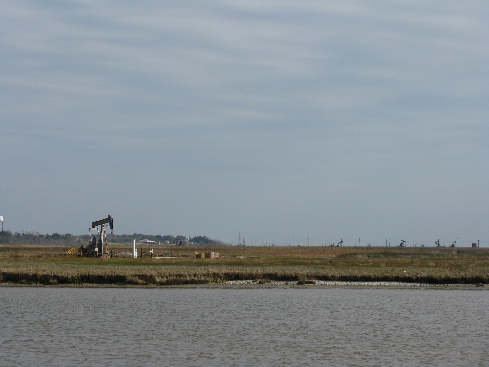
Drilling still goes on. This is the typical small land based drilling well.


I was amazed by the variety of loads being transported on the intercoastal. This load looked like a reel of yellow tubing....but it was huge.


On the 2nd we reached Texas. We have anchored two nights in bends of rivers that were off the Intercoastal Waterway. Now we are back in civilization as we pass through Port Arthur Texas. We saw several pleasure boats marooned on land. We assume this is hurricane Ike aftermath.


Shrimping and fishing are still big in Port Arthur. However, we did see many refineries around the town.


As we headed down next to the Bolivar Peninsula we saw many pumping oil wells as well as lots of hurricane damage on the land structures.


A well known Bolivar Peninsula restaurant and marina for tying up is Steve's Landing. Hurricane Ike destroyed the building. We pulled in and tied to the pilings. No one was around except passing tows.

Monday, January 11, 2010

Houma and Morgan City, LA Dec 28 - 30

We traveled 57 miles west of the Harvey Lock in New Orleans to the town of Houma, LA. Houma has a municipal dock downtown and we tied up in front of this beautifully restored 58' 1971 Trumpy yacht which was made in Annapolis and was once owned by the State of Maryland for the use of the Governor. It is now owned by a man from Houston, Jacob Deegan, that we got to know while we were there. Jacob gave us a tour of his boat and we invited him to dinner. By the way Trumpy built hundreds of PT boats during WWII.
The intercoastal waterway runs right next to the Houma Downtown Marina. While we were there numerous large tows passed by. In the picture just beyond the Trumpy boat, is a tow that is actually towing a barge via a long line.


This picture shows the load on the barge and it is some sort of a chemical plant - possibly for petroleum processing. It was a huge structure. Pushing the barge from the rear (the normal "towing" position) was another tow shown in the third picture.


We stayed two nights in Houma and met another Power Squadron member Steve Willett who keeps a 36' Monk in Houma. We were surprised by their gift of a bag of oranges and lemons from trees in their yards. The fruit was delicious.
In the Gulf Intercoastal Waterway we saw many vessels like the one pictured on the right. They don't need to worry about anchoring, they just lower the pipe supports and they are secure. I am not sure about the purpose of these vessels but I think they are for servicing the off shore well heads and processing plants. Off shore in this case is less than 20-30 feet of water which is the common depth in the near gulf shore areas.

Now we know we are in a swamp. This is the Atchafalaya Swamp. This is the typical shoreline after we left Houma. Most of the streams in this area are named Bayou something. We are in the heart of Cajun/Creole country and the accents on the radio prove it.


As we motored along we were passed by three tow boats that had come out of an interesting river after probably dropping off a load of barges. These tow without a barge load are called "light boats". When I first heard this term used on the VHF radio back in New Orleans I thought they were talking about a Coast Guard navigational light tender. It took a couple days before I figured out what they were saying.
This area is the approach to Morgan City, where off shore oil rig related business are prominent.


The Gulf coast has a large population of pelicans. They fly gracefully past our boat and seem much less disturbed by the passage of our boat than Herons or Sea Gulls.


We passed through Bayou Boeuf Locks which have a purpose of blocking saltwater from the Gulf to keep it from going up stream into fresh water Bayous or rivers. When fresh water flow is high the lock doors are open.
As we exited these locks we were in the Berwick Traffic Control area. We had to call in to let them know where we were going. They then told me where to call back in. Unfortunately, the locations they referred to are only known to locals and professional captains because they are not on the nautical charts. One reference was a spot that was a waterway business that had not been there for 10 years.

Bewick Traffic watched our route up to the Atchafalaya River. This is one of the busiest ports on the whole Gulf coasts with tows going east and west on the intercoastal and tows and crew boats going up the river and out to the gulf.
We stayed two nights in Morgan City in a river front bulkhead that is managed by the city of Morgan City. Although you can't see it our boat was tied up just on the other side of the blue fishing trawler in the left center of the picture. A sea wall protects downtown from flood waters.


Morgan City is home to the annual Shrimp and Petroleum Festival, which pretty much tells you what is important in Morgan City. Right now petroleum is predominate. The picture shows the very first off shore rig. It was called "Mr. Charlie" for the man that invented and designed this rig that could be floated to a drilling site and sunk to the bottom to become a stable drilling platform. This one was first used by Shell Oil Company in 1954 and started the whole deep water drilling industry.


A few days a week there is a tour of the rig which is still used for training new rig crews to be everything from drillers and roustabouts, to cooks and laundry crews. This picture is the drilling floor. The rotary floor is what drives the pipe that is in the ground which has a drill bit on the end.


Inside the crew quarters is a display of newer rigs for deeper water. The left model uses longer legs to support the platform and can drill multiple wells. The rig on the right is for floating in deep water to the sight. Then the bottom tank structure is filled with water to lower it. Eight anchors secure the rig in place. Our tour guide related that safety from all types of accidents is paramount in the oil business now. During Katrina there were no oil spills in spite of rigs being pushed off their site.


Morgan City has an interesting array of older homes displayed on a walking tour. This is a restored hotel now used as a office.


This house was not on the walking tour but I thought it was interesting nevertheless.


We had rain most of the time we were there but Morgan City was an interesting town and we enjoyed the Gumbo and seafood at downtown restaurants. We also enjoyed a visit with Charles Culotta of nearby Patterson, LA. Charles is a Power Squadron member out of Lafayette and had been my contact for information about transiting the Gulf Coast. His web site with cruising information has been invaluable.
I was interested in what Charles told me about hunting in the area. Apparently, the locals have to take a boat to go deer hunting. The deer (and ducks) are thick out in the bayou areas around here but you have to cross water to get to them. Also alligator harvesting is a nice sideline for some people including Charles' son. A license and quota are required and then you trap them using meat hung on a hook above water. Once they are captured a rifle shot between their eyes saves the hide for sale. The largest his son ever brought in was 12 feet long.

Friday, January 8, 2010

Industrial Canals and Intercoastal Waterway Dec 26 - Dec 28

We left our marina on the south shore of Ponchartrain and motored a couple miles west and then south to enter the Industrial Canal. The path we took through New Orleans is shown with a red line beside it.


This is the first bridge as we headed south on the Industrial Canal. The bridge operator responded quickly to a call on VHF 13 and raised the bridge as we approached. After that bridge it was all downhill from there. First I got confused about which bridge was an L & N RR Bridge and twice called it to open after I had already passed. Then we had to wait over 90 minutes for tows to get through the Industrial lock which is shown below.


After we cleared the lock and bridges on the Industrial Canal we entered the Mississippi River and headed up river. A Louisiana Power Squadron member I had contacted warned me about what I had to do to get through New Orleans. First, a boat entering the Mississippi River has to call Vessel Traffic Control (VTC) and tell them who you are, where you are, and where you are going. Within a 1/2 mile the VTC was calling "the powerboat near the Navy Ships". Since this sounded like me I called and found out that, although I had reported my information on VHF Ch 67, now the correct VTC channel was VHF 12 as of 8 days ago. So I was trying to monitor Ch 13 for commercial traffic, Ch 67 for Vessel to Vessel, Ch 12 for VTC, and Ch 14 for the locks. It was confusing because at the same time I was trying to sight see things like downtown New Orleans shown above.

Kaye and I have been to New Orleans many times, and I had raced cars in downtown New Orleans twice, but the view was definitely different then on land. This building was right on the waterfront and the trolley that runs though downtown is visible at the base of the building.


This is looking back at downtown with a cruise boat tied up near the main downtown bridge. Vessel Traffic Control had told me to call in when I reached this bridge. The VTC acts like "Air Traffic Controllers." They tell boats where to go, and warn you of other traffic coming. Upon entering the Mississippi they had said there was no traffic coming towards me on the river. About three miles further up river we turned towards Harvey Lock. Unfortunately, just then two tows (tugs pushing 1-2 barges) stopped on the river bank decided to start up and go into the Harvey Lock right where I was headed.


To give the tows room, I turned slightly right, more to the center of the river. Within a moment I heard an air horn blowing. Thinking it was the tows I stepped out of the pilothouse to discover much to my surprise that the horn was from a freighter about 1/4 mile behind us but heading right for us a 13 MPH. I immediately turned right at high speed to get out of the channel. A couple minutes later I took this picture of the freighter that had nearly impaled our American Tug on its bow.


After a few minutes to settle my nerves, we called the Harvey Lock on VHF 14 to request lockage. Much to my surprise they told us to come in and tie up next to a tow. Here we are in the lock.


After a nerve racking day in unfamiliar territory we decided to stop a little early and tied up at a bulkhead at the Boomtown Casino. We walked over to see what was inside and found multiple rooms on multiple floors with hundreds of people gambling. Most were in front of game machines. We played $5.00 in a "slot machine" and went back to the boat.


The next day we headed west on the Gulf Intercoastal Waterway (GIWW). The waterway distances west of Harvey Lock are indicated in miles WHL meaning west of Harvey Lock. The waterway was narrow with some spots curving through Bayous and other areas straight and partially man made. The town we passed showed the importance of fishing to their economy.


We had seen signs advertising air boats rides to explore the swamps and bayous of Louisiana. This was the first air boat we saw.


The GIWW is very commercial. Business servicing fishing or the oil industry are common. Near passages out to the Gulf of Mexico we would see these oil well service business congregated. These boats shown are called crew boats. These boats carry crew in the forward compartments out to off shore oil rigs, thus the name crew boats, but they also carry supplies to the rigs. The supplies can include water, drill "mud", diesel fuel, food, and equipment which was often welded to the rear deck.


In some areas there are dormitories for off shore crew that typically work 12 hours days with 14 days on and 14 days off.


We had seen evidence of hurricane Katrina damage all the way from Mobile.


Monday, December 28, 2009

Turn Right and Head West Dec. 20 - 25

This picture of the nautical charts for the Mississippi Sound shows Mobile bay and the path to New Orleans. If you enlarge the picture the route that we took is a black line (actually the black line was the planned route and a thin red line was the actual route.) A boat coming south out of Mobile Bay can go east to Florida or west to Mississippi. We turned right and went towards Mississippi.


We left the Grand Mariner Marina early in the morning just after this beautiful sunrise.


The fishing trawlers were working Mobile Bay as we headed south from Mobile.


We turned west along the intercoastal waterway channel. Kaye decided to feed the birds so the seagulls and pelicans came storming up behind us to catch a piece of bread.


The first night we anchored just north of Horn Island. The next day we pulled into the Ocean Springs (MS) Municipal Harbor. The town of Ocean Springs has an interesting downtown with a visitors center in this converted railroad station and many good restaurants and shops downtown.


One highlight was the Walter Anderson Museum. Anderson, a native son, became a famous artist in paint and ceramics. This museum is next to the Community Center and displays some of his art.


The interior of the community center was painted by Walter Anderson in his unusual style.


Numerous live oaks lined the streets.


Biloxi is just on the other side of this bay from Ocean Springs.


From Ocean Springs we continued west along the intercoastal waterway. There was no pleasure craft out and suddenly I got a call on the VHF radio from Homeland Security. They were in a boat behind us and wanted to board. So we slowed to idle speed and while still heading west three armed Homeland Security Officers boarded at our stern. The visit was friendly except that when the officer in charge called in to alert their superiors who was on board he called us "an elderly couple." This may have been the first time I have ever been called elderly but I wasn't going to argue with men with guns.

The weather was turning bad on Christmas Eve, so we ran a little faster than normal to try to reach a marina in New Orleans on the 23rd. There are two ways to go into New Orleans, either on the intercoastal directly into the Industrial Canal or slightly north and turn into Lake Pontchartrain. We picked a marina on Lake Pontchartrain. The entry gateway to the main portion of Lake Ponchetrain is these bridges. They are a combination of a highway bridge and a railroad bascule bridge positioned right together. (Bascule means a counterbalance at one end balances the other.) Each had to be contacted on the radio to request an opening.


We celebrated our Lord's birthday on our boat. Kaye had brought some decorations from Tarboro in October so we had a Christmas tree and some other decorations.


Katrina destroyed the marinas on Lake Ponchetrain and nearly all the boats in this marina the (South Shore Marina) were lost. All the docks and power pedestals at South Shore have been replaced and updated. There was still some evidence of the damage around the marina. This picture shows damage on a building that was the entry to a floating gambling casino anchored on the east end of the marina. The floating casino is gone and the land based casino closed up.