Wednesday, August 26, 2009

Rocks, Rapids, Blueberries & Bears August 13 - 15


From our last anchorage in a quiet spot at the Bustard Islands we moved over to Bad River, passing a Canadian Coast Guard vessel working on channel marker buoys. We went up river to a cove and prepared to anchor among 7-8 other boats. About that time a dinghy came up with a fellow on board who suggested that we come tie up next to him on his 34 foot American Tug. This fellow we got to know was Randy Guzar and he and his wife Audrey were the well known American Tug experts for Georgian Bay. (Dick & Nancy White, on Emerald Lady At-41, said that they had told Randy to watch for us.) Randy and some other boaters helped us get tied up against the rock wall pictured. It was fairly vertical wall and we were tied to roots and even one railroad spike that another boater provided for us. It was a great spot and I was able to take a swim every afternoon there.


A couple hours after we tied up Randy came over and asked if we wanted to take a dinghy ride. We decided to take both dinghys so the wives could go too. Randy instructed us how to negotiate the many rapids that were near by. Most of the rapids were strong with a stream 1 - 2 feet high shooting through between large rocks. They didn't look deep enough but with a good head of steam and on plane we were able to jump up through them and also come back down. The first rapid you go through from the anchorage on Bad River even has a name on the charts - Devil Door Rapids. This picture shows Randy and Audrey showing us the way.


Without a guide I would have never attempted these rapids. The Bad River is really part of the French River which was explored by Champlain in 1615. The French River comes from the East and splits into several rivers or channels. One is the French River Western Channel which branches and one branch is the Bad River Channel, usually just called Bad River. North of this area Champlain noted was an area where the Indians came to pick and dry blueberries and raspberries.


The first night we were there Randy had invited all the boaters in the cove to a happy hour on the rocks above his boat. We joined them and had snacks with boaters from various parts of Canada as well as New Jersey and Michigan.

The next day I took the dinghy out by myself to re-investigate the Bad River and the rapids.
There were many different paths and interesting rock formations everywhere. It was fun to traverse the rapids, but when I came to ones I had not been on, I had a good time just heading the bow close in to the flow and matching engine power to the force of the water to try to maintain the dinghy in one spot for as long as possible before the surging water would push me to one side or the other.


This is an example of one of the boats that went down the rapids. We also saw many canoeist who were probably on fishing expeditions.


From the area just above our boat there was excellent blueberry picking. I asked another boater where the good spots were and what to look for. He took me back 50 yards or so to several spots. He thought that most were under pine trees in wetter shaded areas. Any way I found a good supply and picked 3/4 pint in a short time. The blueberries on on low plants almost like ground bushes. They are much smaller than the ones we buy at the store, or else someone else got the big ones first. The picture is of a blueberry plant with a boat hook that I used to feel around for rattle snakes since signs said they were present in this area.


We stayed two nights at Bad River and could have stayed longer. Just after we left out cove to head out the river to Georgian Bay we say this animal swimming across the channel. I called Kaye and told her there was a beaver in front of us. I assume it was a beaver since we saw one during the happy hour the first night. As we got closer I realized it was a bear. (I'm not sure the difference between black bears and brown bears but this one had a black coat.) I slowed the boat to not hit him or scare him and watched as he reached shore, bounded up the side, turned to look at us menacingly, and took off into the woods. It was a neat experience.


I took several still pictures but wished I had used my video camera which was sitting there ready a couple feet away.

With this we left Bad River thinking it was not so "bad" after all.


Friday, August 21, 2009

Rocky Islands August 10 - 12


From Penetang Harbour, we headed NW past Beausoil Island which is a very popular hiking and camping area. The conditions were terrible with rain, fog, and lightning in the distance. We thought about going back but decided to push on through and soon the storm passed although it was overcast all day. This area had numerous rocky islands.


The rock structures on many of the islands were fascinating with some of the sediment layers dissolved away leaving lines and swirls in the rocks bordering the shorelines.


Our goal was an anchorage off Twelve Mile Bay that Jim Borden had recommended. We passed through a narrow opening into a large pool (probably less than 1/8 mile in diameter). We explored the SE corner but a fellow boater called to us and recommended a different spot since we had gotten close to a large rock just below the water. We anchored among about 8 boats and were later joined by others for a total of 15 boats in this pool. The friendly boater Lindy, brought his Waverunner over to converse. I discovered he had been a Canadian Superbike racer many years ago.


The next morning the fog was thick. We elected to stay put for the day which allowed me to change generator oil and do some other maintenance tasks. So on the 11th we started back on the small boat channel that is indicated on the Canadian Charts and is the "lifeline" that leads us through these treacherous surroundings. We anchored one night at Regatta Bay where we got down the dinghy to go to the town of Snug Harbor for ice cream cones and did some exploring. The next day we passed by this lighthouse at Pointe au Baril.


Just after the lighthouse we saw a sign that indicated that this barrel was famous (which partially explained why there was a historical marker note on the charts.) The sign says " The site of the original barrel denoting safe passage through turbulent waters." I had never heard of using a barrel for this but apparently it was done here.

This was also where we left the main small boat channel and went out into Georgian Bay on an alternate channel to avoid a very narrow passage at Hangdog Channel (not recommended for boats over 40 ft.) After 7-8 miles we rejoined the normal small boat channel. I found two or three places where my 2009 Navionics charts (that I purchased for my Raymarine C-120 chart plotter before I left) were more accurate than the older electronic charts that I had been given to use on my Coastal Explorer software on my laptop. The Canadian Coast Guard moved the channels and markers a few years ago, so you had to pay close attention to where you were going.


The rock formations are starting to show more color. Many were reddish. These were in Bad River which is the site of our next adventure.


Georgian Bay August 7 -9

Port Severn is the end of the Trent Severn Waterway but it also becomes the beginning of Georgian Bay. We headed out through the narrow Potato Channel and into Georgian Bay. On the south side of Georgian Bay is a land mass that separates Georgian Bay from Lake Huron. There are several long natural harbors along this south shore. Our first stop was a marina down the Penetang Harbour at the town of Penetanguishene. The friendly folks at Hindson Marine gave us rides into town to the grocery store the first day, and to downtown (pictured) and a great evening meal at the Greek restaurant called Olympia. They also told us about a fellow from Texas that kept a boat at the marina. The last morning just before we left we met Jim Borden who is from Texas but has been boating in the Georgian Bay/North Channel for 10 years. Jim answered questions about things and places we should see and generously loaned me his strip charts of that area with his favorite anchorages marked on the chart.

After two nights at Hindson Marine we left and went a few miles north in the harbor to anchor near Discovery Harbour. This was the site of a British Naval Base in the early 1800's. It was mainly a supply base for the British Fleet in the Great Lakes. Some of the structures have been refurbished and some reproductions built. This becomes an open air museum of life on a British Naval base.


This picture shows a reproduced supply ship the "H.M.S Tecumseth".


One function of the base was to support Hydrographers. These were the marine version of land surveyors. One outstanding Hydrographer was Henry Bayfield, an officer in the British Navy who served at this base. At a rate of 100 islands per day, he was able over two years to document most of the 36,000 islands of the Georgian Bay/North Channel using simple tools to triangulate for distance and lead lines to check depths. He created navigational charts of Georgian Bay that were accurate enough to still be used through the first half of the 20th Century. I have a picture of the sign about his contribution, but unfortunately after I got back to the boat I realized that in order to get a better lighted sign picture I had switched and taken the wrong side of the sign.........the French language side. Canada has dual languages on everything, and I had forgotten that fact.

Orillia and the Big Chute August 2 - 6


After leaving our overnight spot tied up to the wall at lock 40 we went through Lock 41 and out into Lake Simcoe. Lake Simcoe at 19 miles long by 16 miles wide is the largest body of water on the Trent Severn. It has a reputation of kicking up large waves when the wind blows but our conditions were fairly good. However, an anchorage I stopped at on the northeast shore was a little rough so we went through The Narrows into Lake Couchiching near the town of Orillia. We took the dinghy over to the Municipal Docks to check out where we had a reservation for the next three nights. There was a little fair at a park next to the marina so Kaye wanted to ride the ferris wheel.


The main street of downtown Orrillia started right next to the Port of Orillia marina. There were many stores and restaurants and an excellent bakery (the lemon cake was delicious.) While walking the street I saw this street sign in what looked to be an alley. Later I found out that Orillia is the original home of Gordon Lightfoot, one of my favorite singers.


Every Sunday night the community has a music group in to do a concert at the "band shell". This night was a community band formed that had first formed from ex-high school band members from two Toronto area high schools. Twenty years later they are still performing. It was pleasant view with the lake in the background.


After three nights we resumed our trip heading northwest towards the last part of the waterway.


Another landmark on the Trent Severn waterway is the Big Chute marine railway. This is a special rail car design to move boats from a higher level to the lower water by carrying boats over land and down to the lower level (57' lower). We tied up at a Parks Canada floating dock just above the lock for the night. This allowed me to check out this unique mechanism and see how we would negotiate this "lock" the next day.


This is the railcar loaded with boats at the top of the trip on land. The railcar goes down into the water to pick up the boats that motor into the structure. Once inside you shut off the motor and the operators lift or support the boat with slings positioned underneath. Some boats like sailboats partially sit on their keel with the straps just providing a steadying support.


The railcar actually moves over a highway as it moves from the upper waterway to the lower Little Chute channel. There are two sets of railroad tracks with one end of the car supported by one set and the other end by a set on the other end. A varying height of the rails allowed the rail car to stay level as it moved up and out and then back down into the water. The car was pulled by cables powered out of a building off to the side of the track.


This is the view from our boat the next morning as we were all by ourselves on the second lift of the morning. We are headed back down into the water.


This is the view looking back at the Big Chute where we just left. The railcar is in the water ready to take a load of boats back. You can see the sides of the car and the tracks leading up the hill.


This is the Port Severn Lock - Lock 45. We have now completed 115 locks since we left North Carolina. Kaye couldn't believe we had been through that many locks when I told her the total. Some are just a blur now but as lock veterans we are starting to feel more confident about handling what ever comes.

Fenelon Falls to Lake Simcoe July 27 - August 1

After Peterborough we passed through a number of regular locks. Above the Lock 26 and town of Lakefield we started to see more rugged terrain. Rocky islands and more rapids were common in this area which is a popular vacation area for Canadians. We will pass through Clear Lake, Stony Lake Pigeon Lake, Sturgeon Lake which are all part of an area called Kawartha Lakes. One popular activity for tourists is to rent a houseboat. They were thick as squirrels and many boat captains quiver with fear when entering a lock with one of these rookie houseboats drivers. (Note that Canada as of September 2009 will require proof of competence which normally is to pass a written test for boater skills. However, as I understand it this license is not required for houseboat renting.)


Since most of these lakes freeze over during the winter most of the docks have a provision for getting them out of the water. Some that are on floats can be pulled up onto shore. This one shown is an example of one that is made to pivot up out of the water.


This is a picture of this area of Ontario, Kawartha Lakes. You can see the numerous lakes used for passages on the Trent Severn.


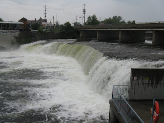
Lock 34 is at Fenlon Falls. The town is named for this falls. This picture is actually the second day after we arrived and had a good nights rain. The entire width of the falls was overflowing.
We were tied up below the lock. We stayed two nights to allow some time to make phone calls. Our Verizon phone was not working and the Pre-Paid Canadian phone had cost over $2.00/minute to call the US. So back to old technology. Yes, I went into a phone booth and used a credit card. Also there was an excellent coffee shop with Wi-Fi service so I sat there several different times to conduct some financial business. Each area of Canada seems to have its own brand of ice cream and we noticed that Canadians love their ice cream. Appropriately, the local brand is called Karwartha ice cream


Our boat was on the falls side of a concrete lock wall and where we were subject to a sideways push from the current. This made it very difficult to get the boat off the wall and backed up to get into the regular channel to the lock (which is to the right in this picture.) I missed a chance to pull the boat backwards by hand before another boat pulled in behind us. We had a hard time getting off.


On August 31 we went through the narrow Trent Canal. We did our "Security" call on VHF channel 16 before entering. There are several spots that are so narrow that passing a boat of our size would be treacherous. This part of the canal was dug by blowing up the limestone, part of the Canadian Shield, that covers half of this country. The chunks of rock were piled up on each side of the canal making a high wall that further enhance the feeling of being in a tunnel.


The water in the canal was so clear that we could see where the rock sides tapered from the bottom of the channel up to the side. Often we were only 5-10 feet from the submerged rocks.


Reached the second hydraulic lift lock on the Trent Severn: the Kirkfield lock. This lock has a lift of 49 feet and works just like the Peterborough Lock but is made of structural steel rather than concrete like Peterborough. This lock is in a fairly rural area so there were not as many spectators as at Peterborough. There was a nice series of signs explaining the operation of the lock.


This picture is the lock chamber at the top. We are in with a little 19' aluminium boat ahead of us and a power boat behind us. The view is eerie because you are just looking out into open space. The gentleman ahead is a retired Canadian who we spent time talking to while tied up at Lock 40 that night. He travels several weeks every summer usually by himself exploring the canals and lakes. He used to do canoeing but switched to this aluminium boat several years ago. He has a small bed and his accommodations are simple but self-contained.


Going through Lock 39 we saw a scape mark on the algae covered walls left by a previous looper. AGLCA is of course the America's Great Loop Cruisers' Association of which we are members and fly their highly recognizable burgee on our bow flagstaff. So obviously, "Loopers" have been coming through.


Friday, August 7, 2009

Trent Severn @Peterborough July 23 - 26

From Campbellford on Mile 31 we spent two days moving through the waterway and one night anchored in Burrison's Bay in Rice Lake. I'll have to admit that some of the lock moorings and anchorages are starting to blend together in my memory so that I can't remember anything significant about them. But I do remember this picture taken by a lock worker at Lock 19 just before we got to Little Lake and the town of Peterborough and the Peterborough Marina.
(That glow around my head is not my angelic disposition showing. It is actually the Satellite TV antenna dome.)


We reached Peterborough on Friday and took a walk downtown for some shopping. There was a long main street with interesting old buildings and more used book stores than I have ever seen in my life. There must have been six in a three square block area. Since Kaye bought me at sweatshirt for Christmas that said "Deliver me from temptation.....especially bookstores", I have been trying to stay away, but this was too tempting. I'll admit I succumbed.


We started Saturday with a bike/scooter ride to the Peterborough Canoe Museum which was housed in the ex-Peterborough Canoe Company building. At one time there were many major canoe manufacturers in Peterborough. The excellent museum had many examples of current, recent, and native Indian (First Nation) canoes. It was interesting that as the chart shows different regions had distinctive bows on their canoes partly to match the type of water encountered in their area and partly to best match the available natural materials.


Later in the day I bicycled out to the Peterborough city museum, which was near the Peterborough Lift lock. The lock has the highest lift (65 feet) of any hydraulic lift lock in North American. An hydraulic lift lock is two basins that can be closed off at each end to make a tub. The upper tub is filled with one foot more height of water than the lower which makes it weigh about 144,000 pounds more. This force is channeled to the ram on the lower chamber which lifts the lower chamber up to the top (and lowers the upper chamber down to the bottom.) The rate of rise (and fall) is controlled by a valve. The lock is massive and was completed in 1904. The design was inspired by hydraulic lift locks in Belgium and France.


The picture of the diagram unfortunately did not capture all the description on the left but you get a basic idea of the operation.


The structure is so massive that the road from downtown Peterborough actually passes under the lift lock although its only a one lane road.


Saturday afternoon, right after I returned from buying carry-out Indian food for dinner it started to rain. This unfortunately caused the cancellation of a concert by a young Canadian country star that was to be right next to the marina. On Sunday we walked a rather long distance downtown to St. Paul's Presbyterian Church for their morning service. The Reverend George Turner had come from Scotland in about 1979 and he still had a strong Scottish Brogue. I was interested to read that he had served as a minister in the town of Cranstoun, Scotland before immigrating to Canada. The Cranston family comes from Scotland.


We left the Peterborough Marina about 12:30 and immediately went through a regular lock. There was a large boat in front of us and a tour boat beside us so that we just barely fit. I had to keep pushing the tour boat away from us as we locked up. I handed my camera over to one of the passengers on the tour boat and she took my picture. It had started to rain just before we entered the lock and stopped just after we exited so we got wet.


The tour boat is entering the lift lock. I tied up on the canal wall to allow Kaye to go through the excellent visitors center there (and to give me time to watch the Formula 1 race on TV.) After an 1 1/2 hours, we were ready to go up in the lock.


Our water basin is now at the top of the lift. The picture is from the stern of our boat looking back at where we had come from. You get some perspective of how high above the road and waterway we are.


This is from our boat at the top of the lift looking out over the bow of our boat. The "wall" at the front of the basin will be lowered to allow us to go out into the canal. I mounted a video camera on a tripod on the front topside of the boat to record most of the locking procedure.